East District Sector Maps
The East District includes areas in the City of Joliet east of the Des Plaines River, and currently has 6 Sectors (11-16). It includes:
- Joliet Police Department Main station (150 W Washington St, Joliet, IL 60432).
- Downtown City Center (Harrah's Casino, The Rialto, The Forge, and many other entertainment venues)
- Pilcher Park.
- Joliet Township East High School & Joliet Township Pathways Academy.
- Far-south commercial district (CenterPoint, Intermodal, Chicagoland Speedway, Joliet Autobahn)
- Forest Park, Liberty Meadows, Ridgewood, Neufairfield, Thunder Ridge, Springview West, Edgecreek Estates, Chestnut Pointe, Bee Dee Highlands, Neufairfield, Parkwood, Fairview, Edgecreek, Cedar Creek neighborhoods.
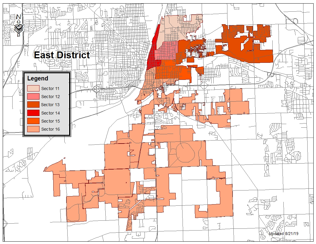
Sector 11
Includes Forest Park and Liberty Meadow Estates neighborhoods.

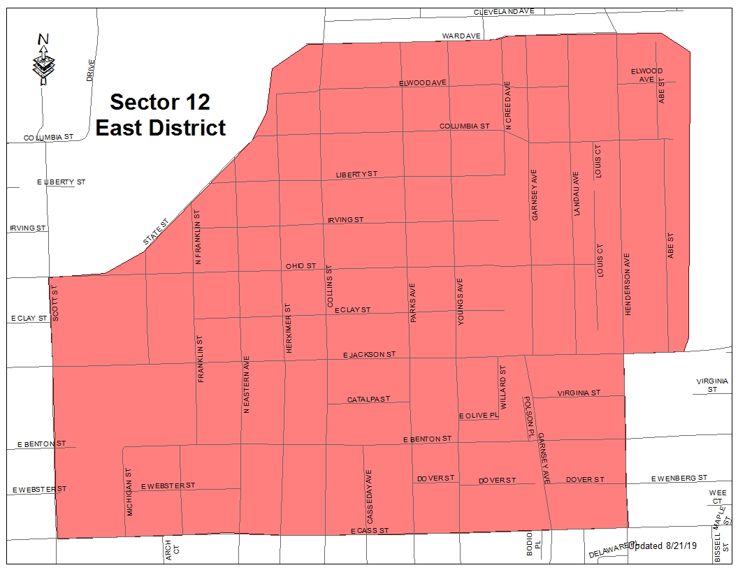
Sector 12
Includes the Benton & Garnsey neighborhood and a section of the Collins St corridor.
Sector 13
Includes Pilcher Park, and Ridgewood, Neufairfield, Thunder Ridge, Springview West, Edgecreek Estates, Chestnut Pointe, Bee Dee Highlands neighborhoods. Some New Lenox mailing addresses are included in the far east portion of this sector.

Sector 14
Includes the Joliet Police Department Main station (150 W Washington St, Joliet, IL 60432), and the Downtown City Center (Harrah's Casino, The Rialto, The Forge, and many other entertainment venues).

Sector 15
Includes Joliet Township East High School, Joliet Township Pathways Academy, and neighborhoods generally between Cass St to 4th Ave and Chicago St to Briggs St.

Sector 16
Includes areas mainly south of Interstate 80, the Far-south commercial district (CenterPoint, Intermodal, Chicagoland Speedway, Joliet Autobahn), and the Cedar Creek neighborhood.
